Afaylu:401 Gridlock.jpg
Aller à la navigation
Aller à la recherche

Aksay n uẓṛi ad :800×510 piksil Tibuda yaḍnin:320×204 piksil | 640×408 piksil | 1 024×652 piksil | 1 554×990 piksil
Afaylu anṣli (1 554 × 990 piksil, tiddi n ufaylu: 284 kio, anaw MIME: image/jpeg)
Azgzl
| Aglam |
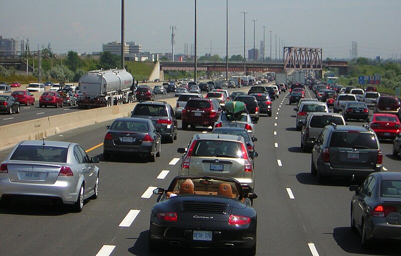
English: Traffic congestion along Ontario Highway 401 |
| Asakud | Prise le 31 Yulyu 2009 |
| Asagm | https://www.flickr.com/photos/bob406/3860422159/ |
| Amgay | Robert Jack 啸风 Will |
Taragt
Ce fichier est disponible selon les termes de la licence Creative Commons Attribution – Partage dans les Mêmes Conditions 2.0 Générique
- Tgit win ixf nnk/nnm:
- fsr – afad ad tnɣlt, ad tzuzrt nɣ ad tbḍut tawuri ad
- sgiddi – sgiddi tawuri
- Ddu tfadiwin ad:
- Tibbabwt – Iqqan d ad tbdrm ism n umskar anṣli tbdrm ula asɣun immaln amskar n umahil nɣ bab n izrfan, tbdrm iɣ ittwasnfl zgis kra nɣ d uhu. Tzḍarm ad tskrm mk ad s mk da tram, maccan s kra n tɣarast immaln ma s d imsacka bab n twuri.
- fsr ikniwn – Iɣ tsnflm nɣ tsmattim nɣ tẓkim f twuri ad, illa fllawn ad tbḍum tumutin nnun ddu turaqt ann nit nɣ kra n turagt d yuckan d tdslant.
| This image was originally posted to Flickr by Bicycle Bob at https://www.flickr.com/photos/81012549@N00/3860422159. It was reviewed on 00:17, 21 April 2010 (UTC) by FlickreviewR, who found it to be licensed under the terms of the cc-by-sa-2.0, which is compatible with the Commons. It is, however, not the same license as specified on upload, which was the cc-by-2.0, and it is unknown whether that license ever was valid. |
Amzruy n ufaylu
Adr i usakud/akud ad tẓrt afaylu mk lli tt inn ikka ɣ tizi ann.
| Asakud/Akud | Tawlaft mẓẓin | Imnadn | Asmras | Axfawal | |
|---|---|---|---|---|---|
| amiran | 13 Ibrir 2024 à 07:54 | | 1 554 × 990 (284 kio) | SCHolar44 | Cropped 3 % horizontally, 7 % vertically, rotated -2.12° using CropTool with precise mode. Reason: rotation for verticality. |
| 20 Ibrir 2010 à 19:33 |  | 1 600 × 1 066 (317 kio) | Haljackey | {{Information |Description={{en|1=Traffic congestion along Highway 401}} |Source=http://www.flickr.com/photos/bob406/3860422159/ |Author=Bicycle Bob |Date=2009-07-31 |Permission= |other_versions= }} |
Asmrs n ufaylu
tasna ad iḍfarn gis afaylu ad:
Aswuri aɣzuran n ufaylu
Id wiki ad ar swurin s ufaylu ad:
- Asmrs ɣ bcl.wikipedia.org
- Asmrs ɣ bn.wikipedia.org
- Asmrs ɣ ceb.wikipedia.org
- Asmrs ɣ ckb.wikipedia.org
- Asmrs ɣ de.wikipedia.org
- Asmrs ɣ el.wikipedia.org
- Asmrs ɣ en.wikipedia.org
- Asmrs ɣ en.wiktionary.org
- Asmrs ɣ es.wikipedia.org
- Asmrs ɣ fa.wikipedia.org
- Asmrs ɣ fi.wikipedia.org
- Asmrs ɣ fi.wikiquote.org
- Asmrs ɣ fr.wiktionary.org
- Asmrs ɣ incubator.wikimedia.org
- Asmrs ɣ kaa.wikipedia.org
- Asmrs ɣ kcg.wikipedia.org
- Asmrs ɣ kn.wikipedia.org
- Asmrs ɣ ko.wikipedia.org
- Asmrs ɣ mk.wikipedia.org
- Asmrs ɣ my.wikipedia.org
- Asmrs ɣ pt.wikipedia.org
- Asmrs ɣ ru.wikipedia.org
- Asmrs ɣ so.wikipedia.org
- Asmrs ɣ sr.wikipedia.org
- Asmrs ɣ sv.wikipedia.org
- Asmrs ɣ sw.wikipedia.org
- Asmrs ɣ ta.wikipedia.org
- Asmrs ɣ th.wikipedia.org
- Asmrs ɣ tpi.wikipedia.org
- Asmrs ɣ ur.wiktionary.org
Ẓruggar f ussmrs amatay n ufaylu ad.